On September 8, 2024, within the framework of the 8th International Conference of the UNESCO Global Geoparks Network for the Asia-Pacific Region, the UNESCO Global Geoparks Council met, evaluated, and voted to recognize Lang Son Geopark as a UNESCO Global Geopark.
Lang Son Geopark is expected to receive its official recognition certificate 2025 in Chile.
Lạng Sơn Geopark covers 8 districts and cities, including Bac Son, Chi Lang, Huu Lung, Loc Binh, Van Quan, and Lang Son City, with a total area of 4,842.58 km².
Established by the Lang Son Provincial People's Committee in 2021, Lang Son Geopark completed its nomination file with the cooperation of the Lang Son Provincial People's Committee and the Viet Nam National Commission for UNESCO (Ministry of Foreign Affairs) at the end of 2023.
According to evaluations by domestic and international experts, the Lang Son Geopark area mainly consists of carbonate and siliciclastic rocks, as well as mafic-acid-alkaline volcanic-siliciclastic rocks, which have formed over the last 500 million years. The region is divided into 24 geological formations, including 15 formations identified for the first time in Lạng Sơn province.
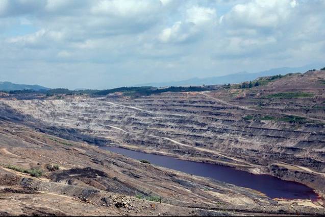
With mountainous terrain covering 80% of the total area, combined with the region's geological history and landscape, Lang Son Geopark is characterized by five major topographical types: tectonic, erosion, denudation, accumulation, and karst. Among these, the karst landscape, in its mature stage, stands out, forming basins and valleys between mountains (e.g., Bac Son limestone massif), tectonic depressions and pull-apart basins (e.g., Na Duong valley, Lang Son City), and denudation hill terrains (e.g., Cong Mau mountain block).
This area also possesses an extensive system of caves, densely concentrated in the Bac Son limestone massif.
 Na Duong valley, located in Loc Binh District (Lang Son Province), was formed approximately 40 million years ago - Photo: Nam Thanh