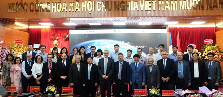
On May 16, the Viet Nam Academy of Science and Technology collaborated with the French Embassy in Viet Nam and Airbus Group to celebrate the 10th anniversary of the successful launch of VNREDSat-1 satellite – Viet Nam's first Earth observation satellite.
The event that Viet Nam's first Earth observation satellite VNREDSat-1 was successfully launched into orbit on May 7, 2013 is an important milestone in the implementation of the Space Technology Development Strategy in Viet Nam as well as the result of close cooperation between the Academy and Airbus Group, is a symbol of the friendship between Viet Nam and France.
According to the report of Dr. Bui Trong Tuyen, Director of the Institute of Space Technology, the agency in charge of implementing the project, VNREDSat-1 satellite has provided nearly 160,000 images in territories, territorial waters of Viet Nam and around the world, bringing full initiative in remote monitoring of natural resources, environment, natural disasters as well as areas of concern, gradually applying scientific and technological advances in monitoring and confirming Vietnamese territorial sovereignty.
The fact that the VNREDSat-1 satellite has been operating twice the scheduled time is not only a testament to the advanced technology of France in general and Airbus Group in particular, but also demonstrates the effective training, transfer and reception between Airbus and the Viet Nam Academy of Science and Technology, Airbus' active support in satellite maintenance as well as the initiative and creativity of Vietnamese staff in satellite operation.

Based on the European Space Commission's assessment of a new era of space technology New Space/Space 4.0 of commercialization, integration and innovation in which space technology applications expand to many future fields, providing applications and solutions directly to people instead of simply developing technology as before, Professor and Academician Chau Van Minh assessed that the participation of many scientific disciplines, the cooperation, integration and development of scientists, research units, technology corporations and countries are important factors in this new era.
In particular, the success of the VNREDSat-1 project, the forward-looking plans of the space technology development strategy in Viet Nam, and the effective cooperation with the French partner possessing the advanced space science background, is the success of the VNREDSat-1 project. As the foundation of the 50-year solid partnership between Viet Nam and France, connecting to the future of a new space era will be a bright reality.
Representing a partner in collaboration with the Viet Nam Academy of Science and Technology to develop the VNREDSat-1 project from early ideas to the present, Ms. Hoang Tri Mai - General Director of Airbus in Viet Nam - said : "Airbus Group is extremely proud to be a partner in this important space project of Viet Nam. VNREDSat-1 satellite has been actively contributing to support the Government to solve challenges in business. We look forward to accompanying Viet Nam on the development of outer space for many decades to come."
French Ambassador to Viet Nam, Mr. Nicolas Warnery, shared: "VNREDSat-1 is a typical example of a very successful cooperation in the field of space and satellite between France and Viet Nam. The special feature of VNREDSat-1 is a testament to the quality of French brand satellites.The French government looks forward to continuing to cooperate with Viet Nam in this strategic area as well as sharing skills and expertise through training of young scientists, researchers and technology transfer to Viet Nam so that Viet Nam can establish an integrated space industry"
At the end of the ceremony, the delegates visited the photo exhibition, looked back at the first images recorded by the VNREDSat-1 satellite in 2013 to the current image and discussed the cooperation plan in the future. Let's step into a new space era with many challenges but also new opportunities.