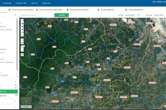
With the extensive coverage provided by remote sensing imagery, this technology is increasingly used to collect and build data for forest protection. For the first time, remote sensing is being utilized to accurately and transparently calculate forest carbon, marking a significant step forward in developing sustainable forest management projects aimed at reducing greenhouse gas emissions from deforestation.
Forest protection as a top priority
Environmental protection and forest resource management have become global responsibilities, not just a national task. Forests play a crucial role in absorbing and storing carbon, helping to maintain atmospheric balance. Protecting forests is the most effective way to combat climate change and is essential for promoting sustainable development.
According to a representative from the Forestry Department under the Ministry of Agriculture and Rural Development, the development of forest carbon credit projects presents a significant opportunity for forest management and protection agencies in Vietnam. This is particularly relevant as demand for carbon credits is proliferating in carbon markets worldwide. Therefore, the development of forest carbon credit markets in Vietnam aligns with global trends and contributes to promoting a green economy.
Verifying forest carbon credits is a process of validating the amount of carbon absorbed and stored by forests or forest ecosystems. This is a critical component of programs like REDD+ (Reducing Emissions from Deforestation and Forest Degradation), where countries or organizations can receive financial support from international funds or organizations for their forest protection and management efforts to reduce carbon emissions and promote sustainable development.
Using satellites to calculate forest carbon
Monitoring and managing forest resources has long been a complex task that requires the integration of modern technologies. Among them, remote sensing imagery has proven to be a highly effective forest monitoring and protection tool.
According to Mr. Le Quoc Hung, Deputy Director of the National Remote Sensing Department, remote sensing technology has been extensively applied in monitoring and verifying forest carbon credits due to its global observation capabilities, cost-efficiency, diverse data sources, high accuracy, and ability to provide continuous updates. Remote sensing allows for large-scale data collection, enabling the monitoring and assessing forests on both local and global scales. This helps identify forest areas with high carbon absorption potential.
Mr. Le Quoc Hung further emphasized that satellite imagery plays a crucial role in carbon credit verification, offering a reliable and efficient means to monitor forest ecosystems worldwide. Satellite images can detect land-use changes, monitor tree growth, track deforestation, estimate biomass, and support biodiversity conservation efforts. Integrating satellite imagery with artificial intelligence (AI) and environmental science can help classify tree species, assess forest density, and detect real-time changes through continuous satellite data analysis. This enables timely detection of deforestation activities, minimizing carbon loss and ensuring forest sustainability.

Research and application of remote sensing technology in forest carbon credit verification
The Future of Remote Sensing in Forest Carbon Monitoring
Looking ahead, remote sensing experts believe that advancements in satellite technology hold great promise for environmental monitoring and carbon credit verification in Viet Nam's forest ecosystems. Improvements in sensor technology are expected to enhance the accuracy and detail of ecological data. Integrating AI with satellite data will likely increase the efficiency of environmental analysis and interpretation, making it easier to detect and assess changes in forests and ecosystems.
Thus, continuing to research and apply remote sensing technology in monitoring and verifying forest carbon credits in Viet Nam will yield essential results in environmental protection and sustainable development and support more effective policy and resource management decisions.